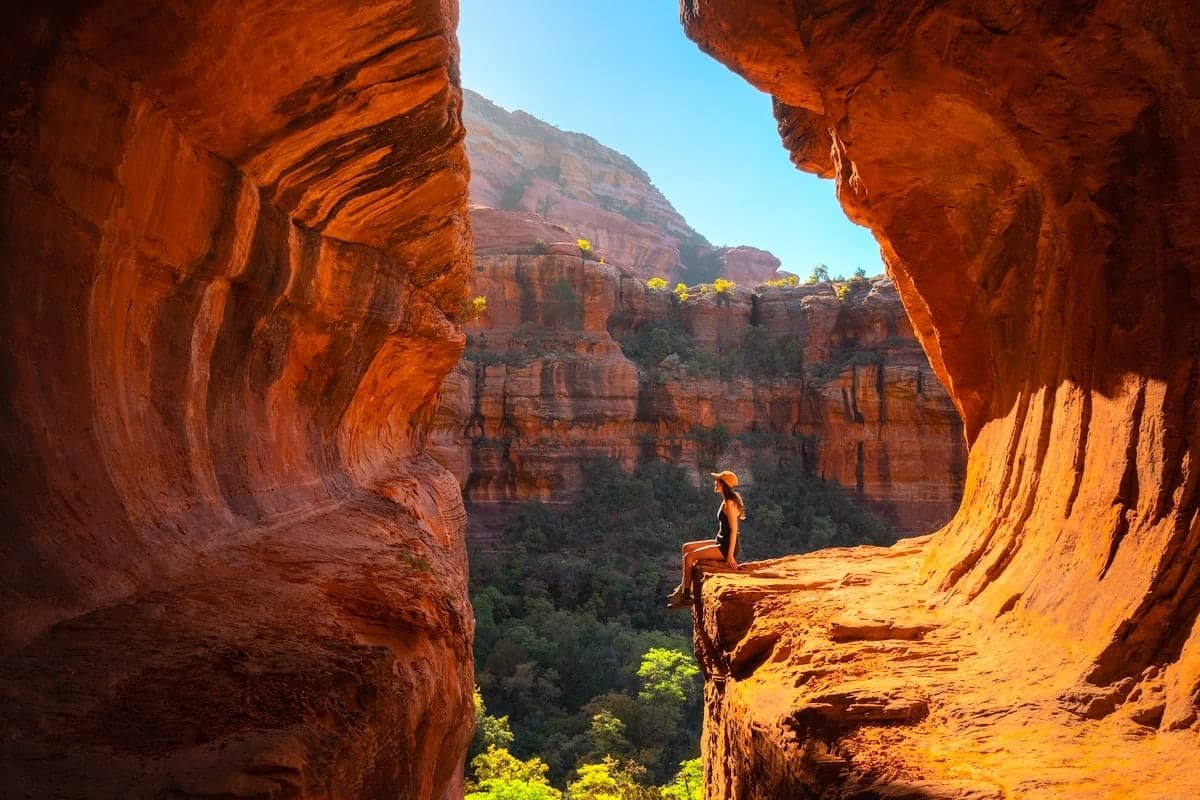
Sedona has more named hiking trails per square mile than almost anywhere in the American Southwest. Some are world-famous bucket-list hikes that fill parking lots by sunrise. Others are quiet locals’ favorites where you can hear yourself think. Here are the trails we send first-time visitors to, organized by what you’re capable of and what kind of experience you want.
Top Picks
Three Hikes You Can’t Leave Sedona Without
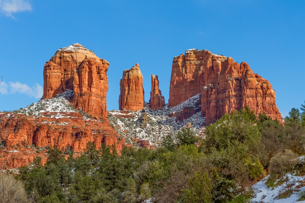
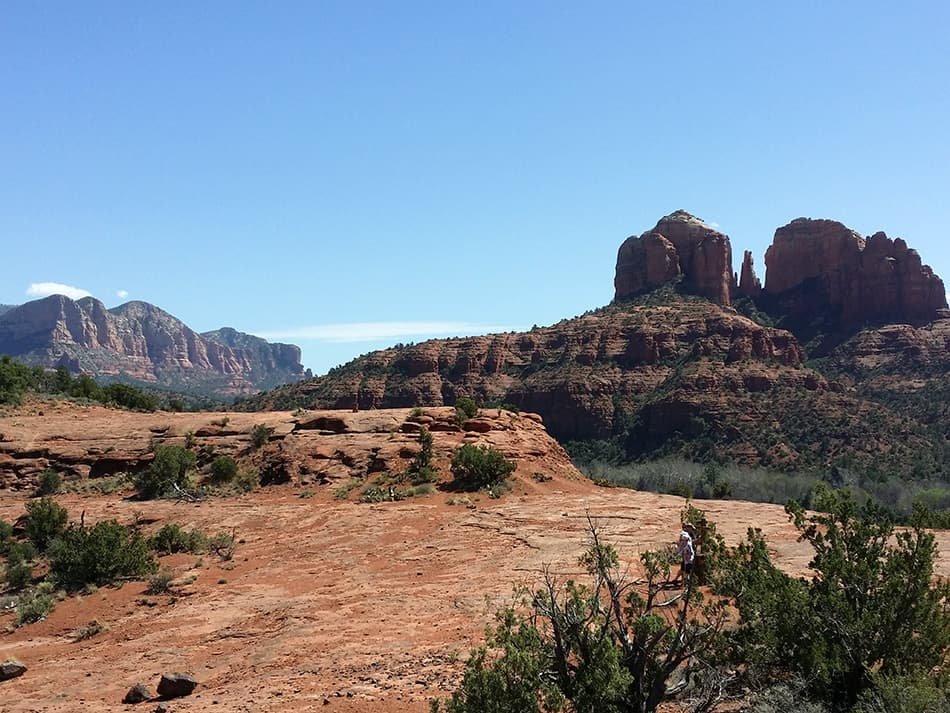
Cathedral Rock Trail
Cathedral Rock is the most photographed view in Sedona for a reason. The hike is short but doesn’t pull punches: you’ll be scrambling up exposed red rock for most of the climb, sometimes using your hands. The reward is the saddle between the spires, where you get a vortex experience whether you believe in vortexes or not. Sunset crowds the parking lot by 4pm. Sunrise is the move.
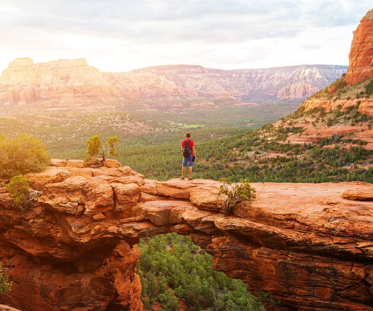
Devil’s Bridge Trail
The largest natural sandstone arch in Sedona, and the most popular hike in the area. The bridge itself is a flat span you can walk across, which is exactly why the photos go viral. Expect a line for the iconic shot, especially mid-morning. The trail is mostly easy until the final scramble to the bridge level.
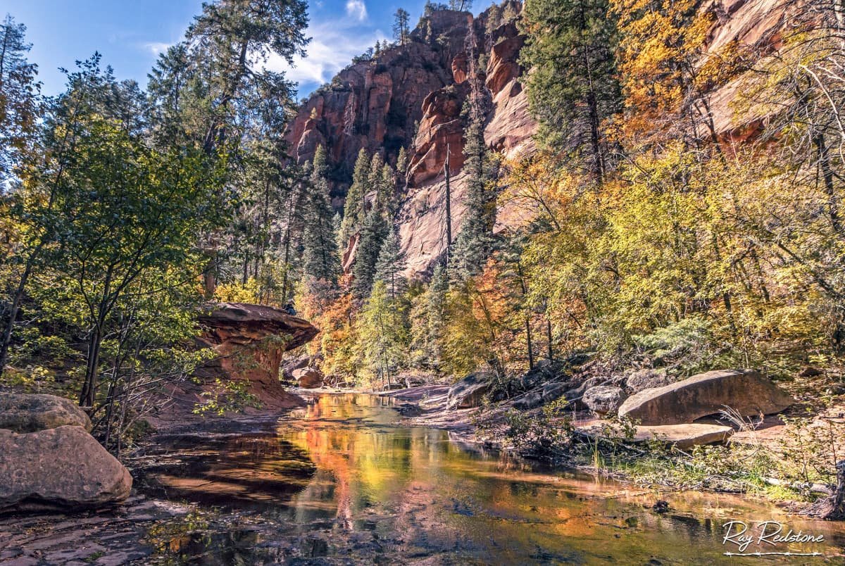
West Fork Trail (Oak Creek Canyon)
West Fork is the answer when the rest of Sedona feels too hot, too exposed, or too crowded. The trail winds through Oak Creek Canyon’s forested floor with cliff walls towering overhead. Thirteen creek crossings on stepping stones keep things interesting. Most hikers turn around at the 2-mile mark, which is plenty for the experience. In late October the canyon turns gold and orange in a way the desert never does.
Easy Hikes in Sedona

These are the trails for families, first-timers, casual hikers, or anyone who wants gorgeous red rock scenery without the lung-burner uphill. All four are accessible to most visitors and offer real Sedona views.
Bell Rock Pathway
Wide, mostly flat path winding around the base of Bell Rock and Courthouse Butte. You can extend the hike by climbing up Bell Rock itself at your own pace. The trail is also a designated vortex site, one of the easier ways to experience that energy if you’re curious.
Sugarloaf Loop
Short but rewarding climb to a small summit with 360-degree views, including Coffee Pot Rock, Capitol Butte, and Chimney Rock. A real loop, no doubling back. Less crowded than the bigger names.
Fay Canyon Trail
Shaded canyon walk with cliff walls on both sides. A short side trail under half a mile climbs to a small natural arch. Family-friendly even with younger kids if they can handle 2 miles total.
Baldwin Trail
Loops through red rock scrub down to Oak Creek and Buddha Beach, a popular swimming and meditation spot. Great hike in summer when you can cool off in the creek. The path is loose dirt and uneven in places.
Moderate Hikes in Sedona
These hikes start asking more of you: more distance, more elevation, more route-finding. The payoffs scale accordingly. If you’re in reasonable shape and have a few hours, these are some of Sedona’s most rewarding trails.
Boynton Canyon Trail
A long, beautiful walk into a sacred Native American canyon. Mostly shaded, mostly easy underfoot, with a steady gentle climb. The famous Subway Cave (an undercut sandstone overhang with Sinaguan ruins above it) is a popular optional detour about halfway in. Also a designated vortex site.
Soldier Pass Trail
Packs more variety than almost any hike of this length: the Seven Sacred Pools (small water-filled depressions in slickrock), Devil’s Kitchen (an active sinkhole that grows by inches every year), and Soldier Arch. Connects to multiple other trails for longer adventures.
Doe Mountain Trail
Short but steep climb to a flat-topped mesa with 360-degree views. Wandering the top of Doe Mountain is part of the experience: it’s wide and worth exploring. Loose rock on the descent, take it slow on the way down.
Birthing Cave (via Long Canyon)
Short hike along Long Canyon ending at a dramatic curved cave with a perfectly oval opening that the spiritual community holds sacred. The final scramble up to the cave is steep and requires hands. The view from inside back out is the photo everyone takes.
Brins Mesa Trail
Climbs out of Soldier Pass to a high mesa with expansive views back over Sedona. Less crowded than the marquee hikes. Can be combined with Soldier Pass or Cibola Pass for longer adventures.
Hard / Advanced Hikes in Sedona
Two of Sedona’s most demanding hikes. Both require real fitness, plenty of water, and an early start. The rewards are the most expansive views in the area and far fewer people than the famous trails.
Bear Mountain Trail
One of the steepest sustained climbs in Sedona. Real rock scrambling, exposed ridgelines, and dramatic drops. Less crowded because most visitors aren’t up for it. The summit views span from Verde Valley to the San Francisco Peaks near Flagstaff. Do not attempt in the middle of a summer afternoon.
Wilson Mountain (North Wilson)
The highest hike in the Sedona area at 7,122 feet. The trail climbs through several ecosystems, from cactus and juniper at the base to pine forest at the top. The summit on a clear day shows you most of Northern Arizona. This is an all-day commitment. Start before dawn.
When to Hike Sedona
Sedona’s hiking season is technically year-round, but each season has tradeoffs. Spring (March through May) and fall (September through November) offer the best weather: 60s and 70s during the day, cool nights, low humidity. Wildflowers in spring, cottonwood gold in fall.
Summer (June through August) brings 90s and 100s, which means you need to start hikes at sunrise and be done by 10am. Monsoon storms roll in afternoons from July through early September, and they bring flash flood risk in canyon hikes. Never enter West Fork or Oak Creek Canyon trails when storms threaten upstream.
Winter is mild and quiet, often with the most dramatic photos when occasional snow dusts the red rocks. Trails can be icy on north-facing slopes; bring traction spikes if you’re going up Bear Mountain or Wilson Mountain in winter.
What to Bring
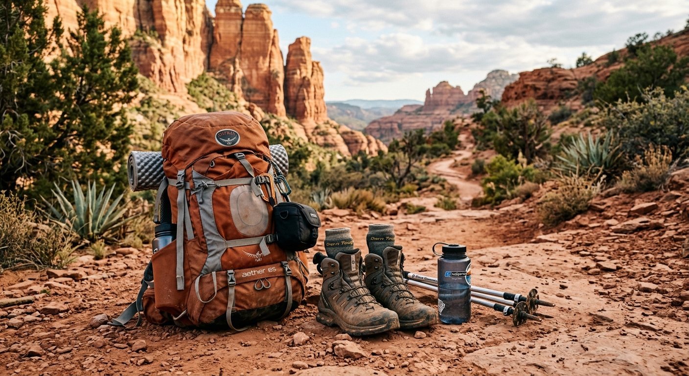
The Sedona desert is more forgiving than the Grand Canyon, but it has the same fundamentals: water, sun, and the unexpected. Plan for at least a liter of water for every hour of hiking, two liters per person minimum on hot days. Sun protection in all seasons including winter: a wide-brim hat, sunscreen, and sunglasses. Sturdy shoes with grip; trail runners are fine for easy and moderate hikes, but Bear Mountain and Wilson Mountain warrant proper hiking shoes. Cell service is spotty in most canyons, so download offline maps before you head out. Pack a snack even on short hikes, and always carry a small first-aid kit with blister care.
Parking and the Red Rock Pass
Most popular trailheads in the Coconino National Forest require a Red Rock Pass for parking. The pass costs $5 daily, $15 weekly, or $20 annually, and you can buy one at trailhead kiosks, the Red Rock Ranger District office, or many Sedona retailers. America the Beautiful National Park passes also work in lieu of a Red Rock Pass. Some popular trailheads (Dry Creek Vista for Devil’s Bridge, Soldier Pass) fill up by 7 or 8am on weekends. If you arrive late and the lot is full, do not park on the road shoulder; rangers actively ticket. Free parking shuttles run from in-town hotels to Dry Creek and Devil’s Bridge trailheads during peak season.
Trail Safety in Sedona
A few things to know that aren’t obvious. Rattlesnakes are present and active March through October. They want to avoid you as much as you want to avoid them. Stay on the trail and watch where you step or put hands on rocks. Flash floods are the most dangerous weather hazard during monsoon season; if you see clouds upstream over the mountains, get out of any canyon trail. The sun is intense even when temperatures feel moderate, and heatstroke and dehydration are real risks. If you start feeling lightheaded or stop sweating, find shade and call for help. Cell service exists at most trailheads and on ridgelines but disappears in canyons.