Sedona, Arizona: The Complete Guide to the Red Rock City
Where it is, why the rocks are red, what the vortexes are, when to come, what to see, and how to park without a ticket. Everything on this page comes from the Forest Service, the state parks, the weather service, the city and the Chamber, checked in October 2026.
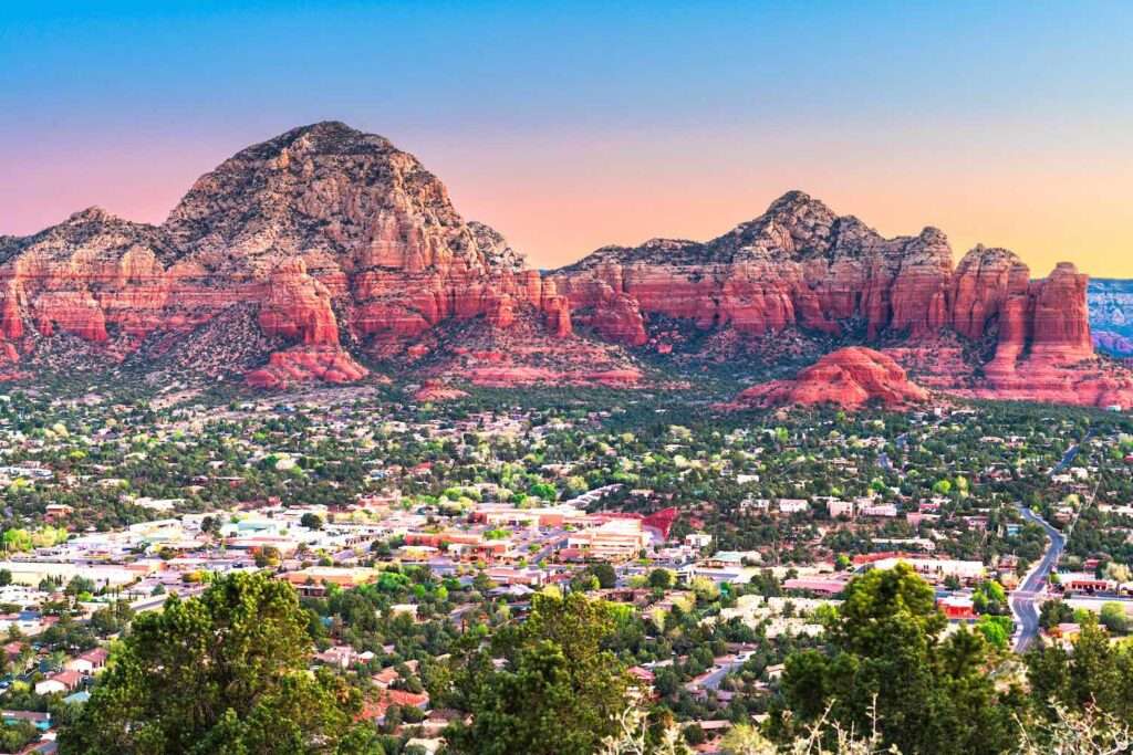
Sedona is a small city of fewer than 10,000 people at the mouth of Oak Creek Canyon in northern Arizona, two hours north of Phoenix and two hours south of the Grand Canyon. It is surrounded by 1.8 million acres of national forest and by the red sandstone buttes and spires that made it a Hollywood western set in the 1940s and 1950s and one of the most visited small towns in the Southwest today. Locals have been publishing this guide in print since 1992. This is the online version.
Sedona’s Best Quick Answer
Sedona is known for its red rock formations (Cathedral Rock, Bell Rock, Courthouse Butte, Devil’s Bridge), its four vortex sites, more than 400 miles of hiking and biking trail, Oak Creek Canyon, a dark sky designation, an art village built in the 1970s, and the Verde Valley wine country next door. It sits at about 4,400 feet, so it runs roughly 15 degrees cooler than Phoenix. The best months are March to May and September to November. There are no airline flights into Sedona; most people drive up from Phoenix Sky Harbor in about two hours. Parking at most trailheads needs a $5 Red Rock Pass.
Where Sedona Is and How to Get Here
Sedona straddles the line between Coconino and Yavapai counties in the northern Verde Valley, below the Mogollon Rim. The 2020 census counted 9,684 residents, with a median age of 58. Arizona does not observe daylight saving time, so Sedona stays on Mountain Standard Time all year, which lines up with Pacific time in summer and Mountain time in winter.
| From | Distance | Drive time |
|---|---|---|
| Phoenix | 113 miles | About 2 hours |
| Grand Canyon South Rim | 114 miles | About 2 hours |
| Flagstaff | About 27 miles via Oak Creek Canyon | About 1 hour on the canyon road |
| Las Vegas | 278 miles | About 5 hours |
| Los Angeles | 482 miles | About 7.5 hours |
Distances and times are the Chamber’s published figures. Sedona Airport has had no scheduled airline service since 1997; it handles private planes and scenic flights. Fly into Phoenix Sky Harbor or Flagstaff Pulliam and drive or take a shuttle. Our Sedona Airport page covers the mesa, its overlook and the vortex.
What Sedona Is Known For

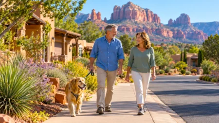
- The red rocks. Buttes, spires and mesas of iron-stained sandstone that turn orange and crimson at sunset. Cathedral Rock is one of the most photographed sights in Arizona; Bell Rock and Courthouse Butte frame the southern approach; Devil’s Bridge is the largest natural sandstone arch in the area.
- The vortexes. Four sites, Airport Mesa, Cathedral Rock, Bell Rock and Boynton Canyon, that the Chamber describes as swirling centers of the earth’s energy said to be conducive to healing, meditation and self-discovery. They draw spiritual seekers from around the world and anchor a whole economy of guides, crystal shops and retreats.
- Hiking and biking. The Red Rock Ranger District maintains about 400 miles of trail, from the paved Bell Rock Pathway to the exposed cliff ledges of Hiline and Hangover. See our best hikes and biking guides.
- Oak Creek Canyon. A 12 mile gorge up to 2,000 feet deep that carries State Route 89A from Sedona to Flagstaff past swimming holes, Slide Rock State Park and the West Fork trail.
- Dark skies. Sedona became the world’s eighth International Dark Sky Community in 2014, and the Village of Oak Creek followed in 2016. See where to stargaze.
- Hollywood. More than sixty productions filmed here between 1923 and the 1970s, including Broken Arrow, Johnny Guitar and 3:10 to Yuma, which is why one historian called Sedona “Arizona’s Little Hollywood.”
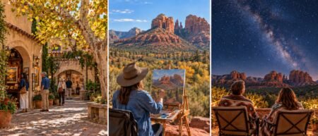
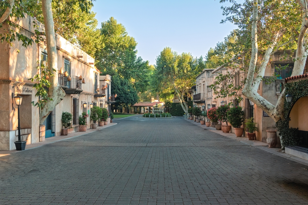
- Art and shopping. Tlaquepaque, the courtyard arts village modeled on a town near Guadalajara, opened in 1973 and holds 18 galleries and 45 shops under its sycamores. Uptown and West Sedona add dozens more. See shopping in Sedona.
- Wine. The Verde Valley became a federally recognized American Viticultural Area in November 2021, with 11 wineries and two dozen vineyards 25 minutes down the road. See Sedona wine and beer.
Why the Rocks Are Red
The color is rust. The spires and buttes around town are carved mostly from the Schnebly Hill Formation, a layer of sandstone and siltstone 800 to 1,000 feet thick that was laid down roughly 286 to 273 million years ago, when this corner of Arizona sat on the western shore of the supercontinent Pangaea. Iron in the sediment oxidized into hematite, the same mineral that colors rust, and it coats every grain.
Look at any big formation and you can read the stack. The brick-red base is the older Hermit Formation, silt and sand from ancient river floodplains. The bulk of the cliff is the Schnebly Hill Formation. The pale cap on the highest rims is Coconino Sandstone, the fossilized remains of a dune field that began blowing across the region about 275 million years ago, with the steep cross-bedding of the dunes still visible. Above that, on the Mogollon Rim itself, sits Kaibab Limestone, and on some rims a lid of volcanic basalt only about 6 million years old.
Oak Creek Canyon is the youngest piece of the story. An ancestral canyon formed along the Oak Creek Fault 8 to 10 million years ago, filled with gravel and lava, and then the fault moved again and the creek cut the modern canyon, which is why the west rim stands about 700 feet higher than the east. Our history of Sedona goes deeper on all of this.
A Short History
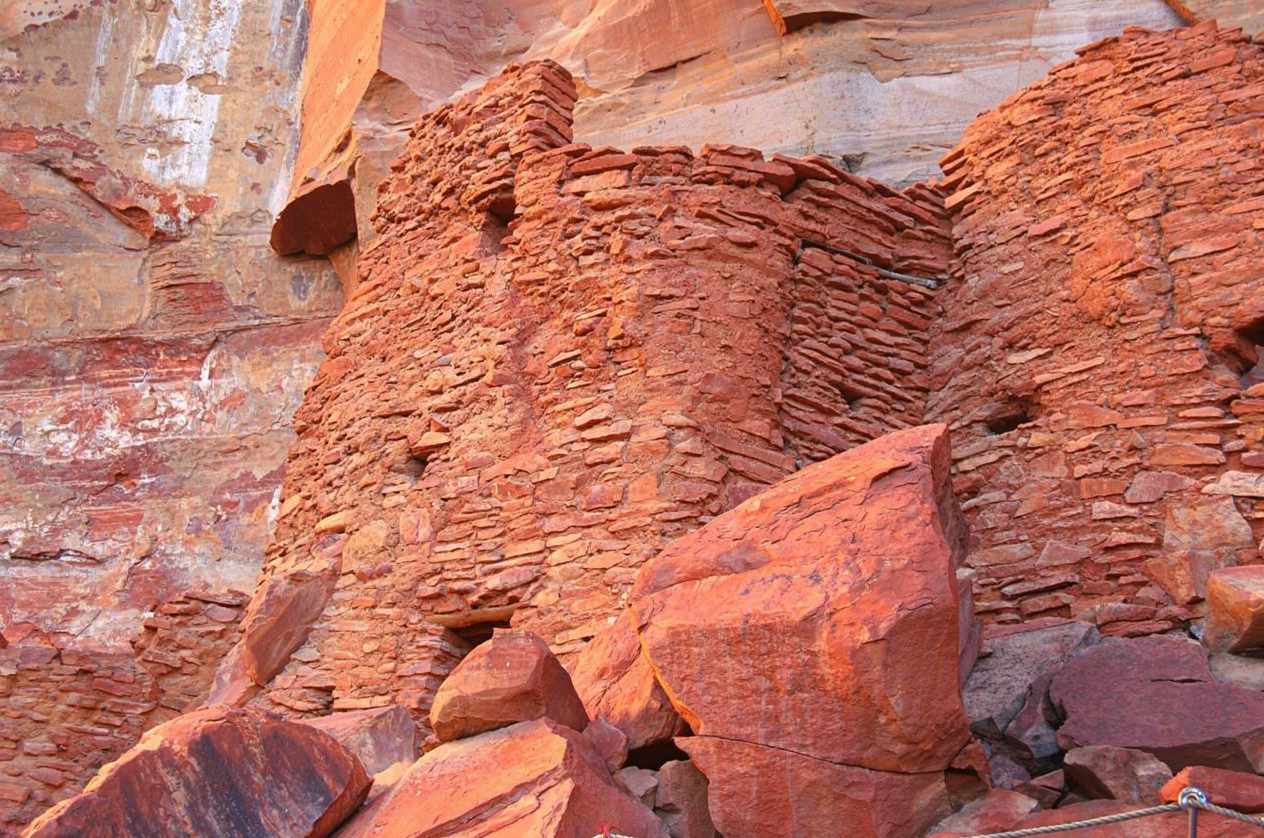
- 900 to 1400. The Sinagua, ancestors of the Hopi, farm the Verde Valley and build the cliff dwellings at Palatki and Honanki (1150 to 1350), Montezuma Castle (begun around 1100) and the hundred-room pueblo at Tuzigoot. More than a thousand petroglyphs are inscribed at the Crane Petroglyph Heritage Site between 900 and 1300.
- 1400s onward. The Yavapai, and later the Western Apache, move into the valley; their descendants form today’s Yavapai-Apache Nation. In March 1875 the Army marched about 1,500 Yavapai and Apache 180 miles to San Carlos; only about 200 made it back when they were allowed to return in 1900.
- 1876. John James Thompson files the first homestead claim on lower Oak Creek at what is now Indian Gardens.
- 1902. The post office opens in the back of T.C. and Sedona Schnebly’s home on June 26, named for his wife. The settlement has 55 residents.
- 1923 to 1973. Hollywood arrives with Call of the Canyon and keeps coming for half a century.
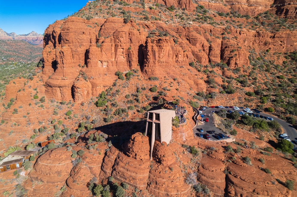
- 1956. The Chapel of the Holy Cross, commissioned by rancher and sculptor Marguerite Brunswig Staude, opens on its red rock spur with a 90 foot cross; it wins an American Institute of Architects award the next year.
- 1960. Don Pratt starts Pink Jeep Tours, which still holds the only commercial tour permit on the Broken Arrow trail.
- 1973. Abe Miller opens Tlaquepaque.
- 1988. Sedona incorporates as a city. Slide Rock State Park had been dedicated the year before; Red Rock State Park follows in 1991.
- 2014. International Dark Sky Community designation.
The Lay of the Land
Two state highways meet at a junction everyone calls the Y, and the town arranges itself around it.
- Uptown is north of the Y on 89A: the walkable strip of galleries, restaurants, tour desks and the Sedona Heritage Museum in Jordan Historical Park. Street and garage parking here is paid, 9 a.m. to 6 p.m. daily.
- West Sedona runs west along 89A: most of the hotels, the grocery stores, the airport mesa, and the rental shops for ATVs and side-by-sides. The Dry Creek and Boynton Canyon trailheads are reached from here.
- South on SR 179, the Red Rock Scenic Byway, is Tlaquepaque, the Chapel of the Holy Cross turnoff, the Bell Rock and Courthouse Butte trailheads, and after about 7.5 miles the Village of Oak Creek, an unincorporated community of about 6,000 that sits closest to the big southern formations. The Federal Highway Administration designated this stretch an All-American Road, its highest scenic byway rank.
- Oak Creek Canyon is north of Uptown on 89A: 15 paved miles that climb 2,200 feet past Midgley Bridge, Slide Rock and the West Fork trailhead to the switchbacks and the Oak Creek Vista at the top. Budget an hour one way.
- Schnebly Hill Road leaves 179 just south of the Y and climbs to a 5,980 foot vista on the rim. The Forest Service says not to attempt it from Sedona without a high-clearance four-wheel drive; it is Jeep tour country, and the upper section closes in winter.
Getting around: the free Sedona Shuttle runs year-round Thursday through Sunday, daily in spring break and on some holidays, from three park and ride lots to the Cathedral Rock, Little Horse, Soldier Pass, Dry Creek Vista and Mescal trailheads. No reservation needed. On the busiest trails it is simply the easiest way in.
Weather and When to Go
These are the National Weather Service’s 30-year normals for the Sedona station, so they are the numbers to plan around, not a travel brochure’s. The year averages 77 degrees for a high, 49 for a low, and 17 inches of rain.
| Jan | Feb | Mar | Apr | May | Jun | Jul | Aug | Sep | Oct | Nov | Dec | |
|---|---|---|---|---|---|---|---|---|---|---|---|---|
| High | 58 | 61 | 68 | 75 | 84 | 94 | 97 | 94 | 89 | 79 | 67 | 58 |
| Low | 34 | 36 | 40 | 44 | 53 | 61 | 68 | 67 | 61 | 51 | 41 | 33 |
| Rain (in) | 2.0 | 2.2 | 1.9 | 0.8 | 0.7 | 0.2 | 1.6 | 2.0 | 1.7 | 1.4 | 1.1 | 1.5 |
Read it this way. March to May and September to November are the sweet spots: highs in the 60s to 80s and almost no rain in April and May. June is the hottest dry month. The monsoon officially runs June 15 to September 30, though the moisture rarely reaches northern Arizona before early July; it delivers 40 to 50 percent of the year’s rain in afternoon storms, and the Weather Service calls flash flooding the biggest threat. Hike early and never drive through flood water. Winter is mild by day and freezing at night; snow is rare in town and usually melts the same day.
Our best time to visit Sedona guide weighs crowds, prices and events month by month, and the Sedona weather page has the seasonal detail.
The Sights
Cathedral Rock
The 4,967 foot icon. The trail is only 1.1 miles round trip but climbs 669 feet of slickrock, and the Forest Service rates it strenuous. Red Rock Pass to park, or ride the shuttle. The classic photo is from Red Rock Crossing at Crescent Moon, $15 a car.
Bell Rock and Courthouse Butte
The pair that greets you on SR 179. Bell Rock (4,919 feet) is a vortex site with an easy pathway around its base; Courthouse Butte (5,454 feet) has a 4.5 mile loop. Trailheads at Bell Rock Vista and Courthouse Vista, pass required.
Chapel of the Holy Cross
A Catholic chapel built into a spur of red rock between 1954 and 1956, with a 90 foot cross as its window. The view from the ramp is the point. See our Chapel guide.
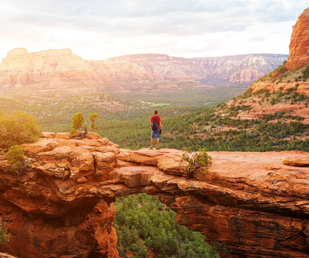
Devil’s Bridge
The largest natural sandstone arch around Sedona, 50 feet high, 1.6 miles round trip from a trailhead on a rough forest road that needs high clearance; most people park at Dry Creek Vista or Mescal and walk in along the road, which adds to the distance.
Airport Mesa
The sunset overlook above West Sedona, $3 to park at the vista lot, with a 3.3 mile loop around the mesa and the Airport Mesa vortex on the saddle.
Slide Rock State Park
A natural water slide in Oak Creek on a 43 acre homestead apple farm from 1907, seven miles up the canyon. $20 per car in the off season, $30 in summer; no reservations. Check our Slide Rock status page before you go.
Boynton Canyon and West Fork
The two great canyon walks. Boynton is 6 miles out and back into a box canyon beside Enchantment Resort and a vortex site. West Fork, 9.5 miles up Oak Creek Canyon, crosses the creek a dozen times under overhanging walls; $15 a car. Both are in our hiking guide.
Tlaquepaque
Cobblestone courtyards, fountains and sycamores, 18 galleries and 45 shops, plus the Day of the Dead celebration in November and the tree lighting in December.
Palatki and Honanki
Sinagua cliff dwellings and rock art 13 miles northwest on gravel roads. Palatki tours are limited to 14 people and must be reserved on Recreation.gov; Honanki is open daily 9:30 to 3. Red Rock Pass, no pets past the parking lot.
Day trips
Montezuma Castle, a five-story cliff dwelling and one of the nation’s first four national monuments ($10, free under 16, includes Tuzigoot). Jerome, the copper town that peaked at 15,000 people in the 1920s and now has fewer than 500. And the Verde Valley wineries and tasting rooms, 25 minutes south.
The Vortexes, Briefly
The Sedona Chamber puts it this way: vortexes are “thought to be swirling centers of the earth’s energy emanating all around us,” said to be conducive to healing, meditation and self-discovery. The four best known are at Airport Mesa, Cathedral Rock, Bell Rock and Boynton Canyon, and the Chamber’s own guide labels Airport Mesa electric, Cathedral Rock magnetic, and Bell Rock and Boynton balanced. It also notes that conventional science has not validated vortexes as a spiritual phenomenon. Whatever you make of that, all four are among the most beautiful places in town, and all four are reachable on an easy walk.
Our Sedona vortex guide maps all four sites with what to expect at each.
Things To Do, by Interest
- On foot: the best hikes in Sedona, from Bell Rock Pathway to Cathedral Rock.
- On wheels: Jeep tours, ATV and UTV rentals, and mountain biking and e-bikes.
- From the air: airplane tours and helicopter tours, including Grand Canyon day trips.
- On the water: kayaking and paddleboarding on the Verde River.
- After dark: stargazing in a Dark Sky Community and full moon hikes.
- For the spirit: the vortex sites, sound baths, crystal shops and spas.
- For the table: the best restaurants in Sedona and wine and beer.
- For the night: where to stay, by neighborhood and budget.
- For the calendar: Sedona events and the wedding guide.
- The whole list: things to do in Sedona.
Passes, Parking and the Rules
- Red Rock Pass. $5 a day, $15 a week, $20 a year, required to park at most Forest Service trailheads including Cathedral Rock, Bell Rock, Courthouse Vista, Boynton Canyon, Baldwin, Little Horse, Mescal, Dry Creek, Palatki and Honanki. Buy at the trailhead kiosk, the visitor centers or Recreation.gov. An America the Beautiful pass works in its place. Stopping 15 minutes or less for a photo needs no pass; a parked car without one can be cited, and 90 cents of every dollar stays in the district.
- Where the pass does not work. Five concessionaire sites charge their own daily fee: West Fork, Crescent Moon, Grasshopper Point, Beaver Creek and Lower Lake Mary. Slide Rock and Red Rock state parks charge state fees.
- Parking. Soldier Pass has 14 spaces and a gate open 8 to 6. The Devil’s Bridge road needs high clearance. Uptown is metered. Item eight of the Chamber’s Sedona Cares Pledge covers the rest: if you can’t find a parking spot, do not invent your own.
- Water and heat. The Forest Service says a gallon per person per day; the city says a liter per hour on the trail, and off the trails by 10 a.m. in summer. Cell service is unreliable in the canyons.
- Pets. Leashed everywhere on the forest, not allowed at Palatki, Honanki, Grasshopper Point or in Red Rock State Park.
- Drones. Banned in the wilderness areas, which cover most of the backcountry around Sedona, and discouraged near trailheads and campgrounds; 400 feet maximum elsewhere.
- Leave it. No stacked stones, no carved names, no new trails. The Chamber’s pledge says it best: make your own memories, but not your own trails.
Annual Events, 2026 to 2027
| Event | When | Notes |
|---|---|---|
| Sedona Yoga Festival | October 1 to 4, 2026 | Moved to fall from its old spring slot. |
| Sedona Arts Festival | October 10 to 11, 2026 | 100 juried artists at Sedona Red Rock High School, $15 two-day admission, 12 and under free. |
| Day of the Dead at Tlaquepaque | November 1, 2026 | Marigold mural project October 29. |
| Sedona Mountain Bike Festival | November 6 to 8, 2026 | Posse Grounds Park; demo bikes, shuttles, clinics. |
| Tlaquepaque tree lighting | December 4, 2026 | The Festival of Lights with its 6,000 luminarias follows in mid December; 2025’s was December 13. |
| RunSedona | February 6, 2027 | Half marathon, 10K and 5K from West Sedona. |
| Sedona International Film Festival | February 20 to 28, 2027 | 33rd edition, more than 150 films. See our festival guide. |
| St. Patrick’s Parade | Mid March | The 50th ran March 14, 2026 on Jordan Road; 2027 date to be announced. |
Dates as published by the organizers on October 1, 2026. The events directory has the week by week calendar.
Sedona, Arizona FAQ
What is Sedona, Arizona known for?
Red sandstone formations such as Cathedral Rock, Bell Rock and Devil’s Bridge, four vortex sites that draw spiritual seekers, about 400 miles of hiking and biking trail, Oak Creek Canyon, an International Dark Sky Community designation, the Tlaquepaque arts village, a Hollywood western film history from 1923 to the 1970s, and the Verde Valley wine region next door.
Where is Sedona, Arizona?
In northern Arizona, at the mouth of Oak Creek Canyon below the Mogollon Rim, straddling the Coconino and Yavapai county line. It is 113 miles and about two hours north of Phoenix, 114 miles and about two hours south of the Grand Canyon South Rim, and about 27 miles south of Flagstaff through Oak Creek Canyon.
What is the elevation of Sedona?
About 4,400 feet. The federal gazetteer lists 4,360 feet and the Chamber uses 4,500 feet; the surrounding formations rise to 4,967 feet at Cathedral Rock and 5,454 feet at Courthouse Butte, and the Mogollon Rim above town tops 6,000 feet. The altitude keeps Sedona roughly 15 degrees cooler than Phoenix.
When is the best time to visit Sedona?
March through May and September through November, when average highs run from the 60s to the 80s and rain is scarce. June is the hottest dry month, with a normal high of 94. The monsoon brings afternoon storms from early July through September. Winter days average 58 to 61 degrees with freezing nights, and snow in town is rare.
What are the Sedona vortexes?
Four sites, Airport Mesa, Cathedral Rock, Bell Rock and Boynton Canyon, that the Sedona Chamber describes as swirling centers of the earth’s energy said to be conducive to healing, meditation and self-discovery. The Chamber also notes that conventional science has not validated them as a spiritual phenomenon. All four are reachable on an easy walk.
Do I need a pass to park in Sedona?
At most Forest Service trailheads, yes: a Red Rock Pass costs $5 a day, $15 a week or $20 a year, and an America the Beautiful pass also works. Five concessionaire sites (West Fork, Crescent Moon, Grasshopper Point, Beaver Creek and Lower Lake Mary) charge their own fee instead, as do Slide Rock and Red Rock state parks. Uptown street and garage parking is metered.
Can you fly into Sedona?
Not on an airline. Sedona Airport has had no scheduled commercial service since 1997 and handles private aircraft and scenic flights. Visitors fly into Phoenix Sky Harbor, about two hours away by car, or Flagstaff Pulliam Airport, and drive or take a shuttle.
Why are the rocks in Sedona red?
The formations are mostly Schnebly Hill Formation sandstone laid down 286 to 273 million years ago, and iron in the sediment oxidized into hematite, the mineral in rust, which coats the grains. The pale caps on the highest rims are Coconino Sandstone, fossilized sand dunes from about 275 million years ago.
Plan the trip
Parking, passes and avoiding crowds
- Red Rock Pass Guide: Do You Need One in Sedona?
- Sedona Trailhead Parking & Free Shuttle Guide
- Best Time to Visit Sedona & How to Avoid the Crowds
- Where to Park in Uptown Sedona